

This guide is designed to show you how to use Google Maps for directions, an essential tool for navigation in the modern world. Google Maps can serve as a valuable resource when attempting to navigate your way around a city, regardless of whether you are traveling on foot or by car. It doesn’t stop there; this innovative platform also offers the ability to plan for and track the routes of other modes of transportation, such as trains, buses, and even bicycles. With Google Maps, you can travel with confidence, knowing that you have accurate, real-time navigation at your fingertips.
Google Maps is a universal tool, meaning it is available across a wide range of platforms. Regardless of whether you use an Android smartphone or tablet, or an Apple iPhone or iPad, Google Maps is there to guide you. This extensive availability is one of the key reasons for its wide adoption worldwide. But it’s not just limited to mobile devices. The software also extends to desktop environments, encompassing both Windows PCs and Apple Macs.
Getting started with Google Maps is straightforward. The first step is to download the Google Maps application, which is readily available on both Google’s Play Store for Android devices and Apple’s App Store for iOS devices. Simply search for “Google Maps” in your device’s app store, click on the install button, and wait for the application to download and install. Once completed, you can launch the application and start exploring.
However, if you prefer to avoid downloading additional software or are running out of storage on your device, don’t fret. Google Maps can be accessed directly from your device’s web browser. Simply navigate to the Google Maps website, and you can start using the same navigation services as the app provides. This web-based version is particularly useful for individuals who frequently switch between devices or for those who prefer to use their desktop computers for route planning. Remember, regardless of the platform you choose, Google Maps provides a consistent and reliable navigation experience.
How to use Google Maps for directions
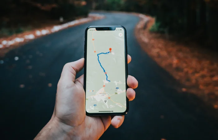
Once you have downloaded the Google Maps app on your iPhone or Android Phone, you can now open the app on your device.
The first thing you need to do is enter your starting point on where you are going to take the journey from, this can be your home address if you are starting out from home, or it can be your current location.
Once you have selected the starting point for your journey you need to enter your destination into Google Maps.
There is a range of options you can choose from here, this includes a specific address with a postcode, a city, or a landmark, something like the Tower of London or Big Ben.
Once you have entered the destination you would like to travel to you can then choose the method of travel, there is a range of options for this.
You can choose from Car, Train, Foot, Bicycle or even an Airplane if this option is available, this will normally be available for longer journies
Once you have selected your method of travel you will then select Get Directions and you will be given directions for your journey.
This will show you how to get to your destination from your current location via your chosen method of travel.
You can also customize your route and add in other places to visit along the way, this is a good feature if you are going on a long car journey and would like to stop somewhere along the way.
You can add the additional destination by selecting the ‘+’ under the current destination, you can then drag any of the destinations into the specific order you would like.
You can also choose a range of other options by selecting the Options menu and you can now make some changes to your route, if you are travelling by car you can choose to avoid things like motorways etc.
A quick guide on using Google Maps for directions.
- Open Google Maps on your phone, tablet, or computer.
- Choose the starting point for your journey.
- Enter your destination.
- Select your method of transport
- Customize your route
- Start your journey.
We sincerely hope that this detailed tutorial on leveraging Google Maps for directions has been beneficial to you. Our goal was to provide a comprehensive overview that aids you in understanding and making full use of this powerful navigational tool, whether you’re a first-time user or a seasoned explorer seeking to enhance your travel efficiency. For further information and a deeper dive into the world of Google Maps, we would recommend exploring Google’s official website. This platform houses a wealth of resources, including FAQs, user guides, and advanced features that can further enrich your experience and understanding of Google Maps.
Your thoughts, ideas, and queries are of great importance to us. If there are any comments, questions, or suggestions that you may have, we wholeheartedly encourage you to share them with us in the comments section below. We believe that each individual’s perspective is invaluable and can significantly contribute to the collective learning experience. Whether you have a simple query or an insightful suggestion, every piece of feedback is welcome and appreciated. This dialogue allows us to improve the quality of our guides, respond to your specific needs, and foster a vibrant and interactive community.
Image Credit: Tamas Tuzes-Katai
Filed Under: Guides
Latest Aboutworldnews Deals
Disclosure: Some of our articles include affiliate links. If you buy something through one of these links, Aboutworldnews may earn an affiliate commission. Learn about our Disclosure Policy.